|
| General Land Office 4.5 foot Vegetation Line for Pirates Beach |
|
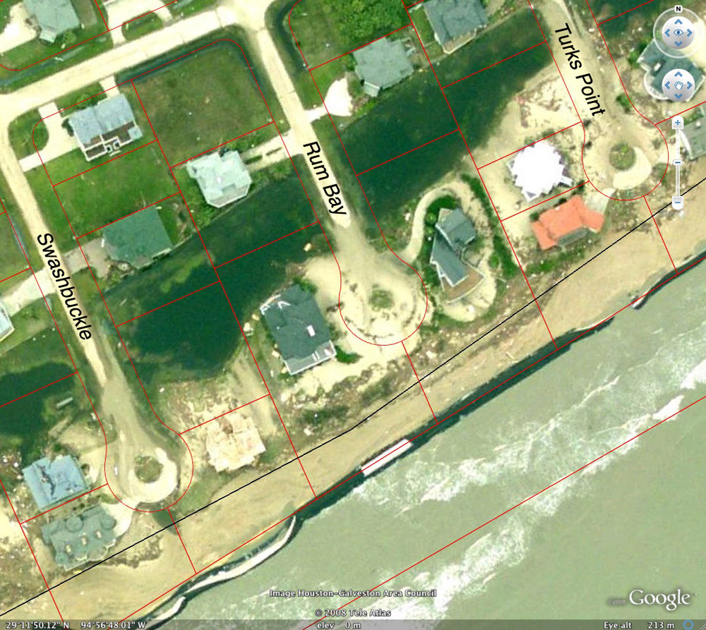
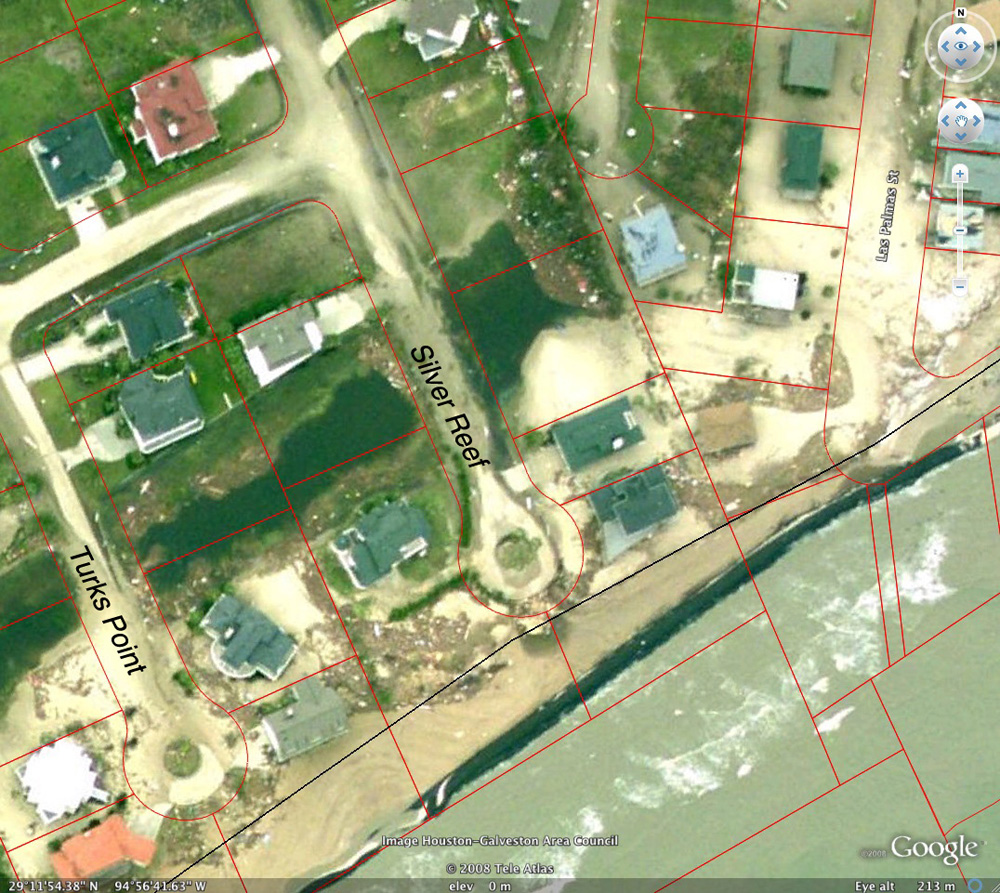
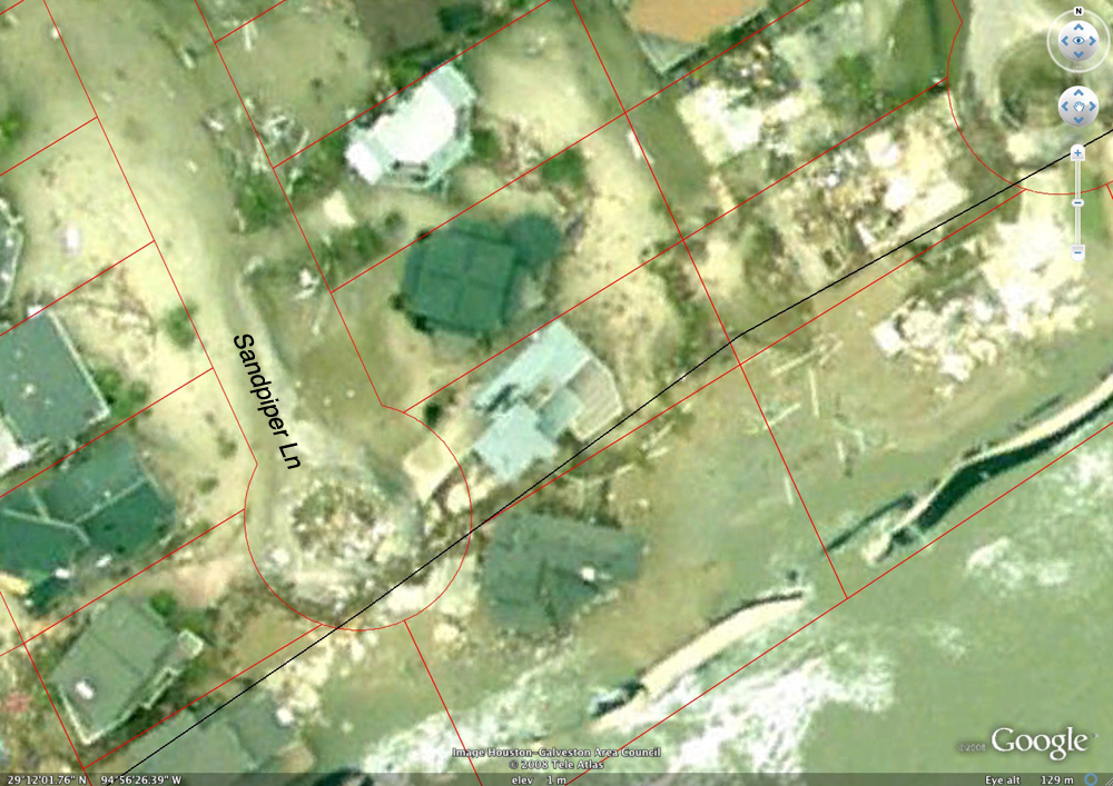
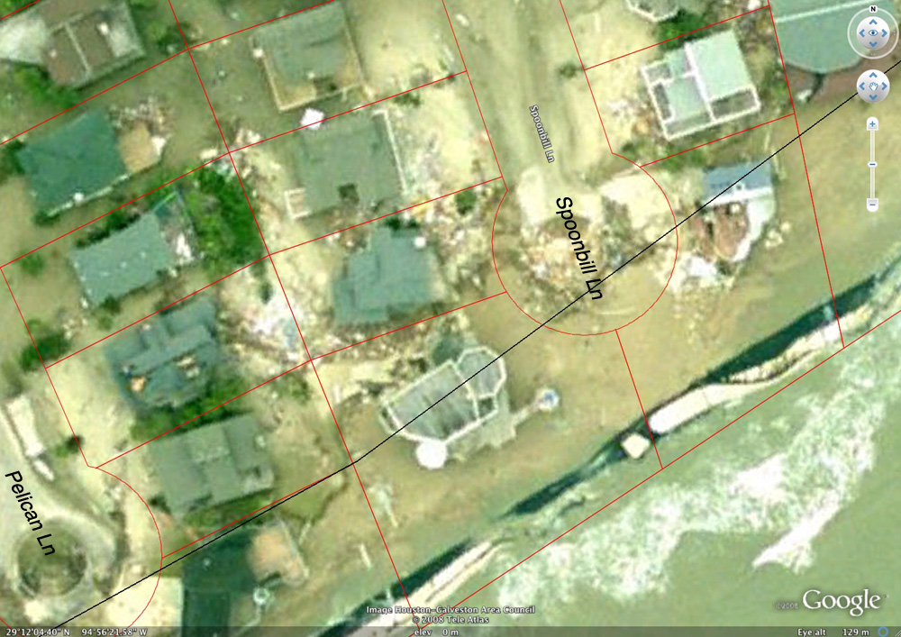
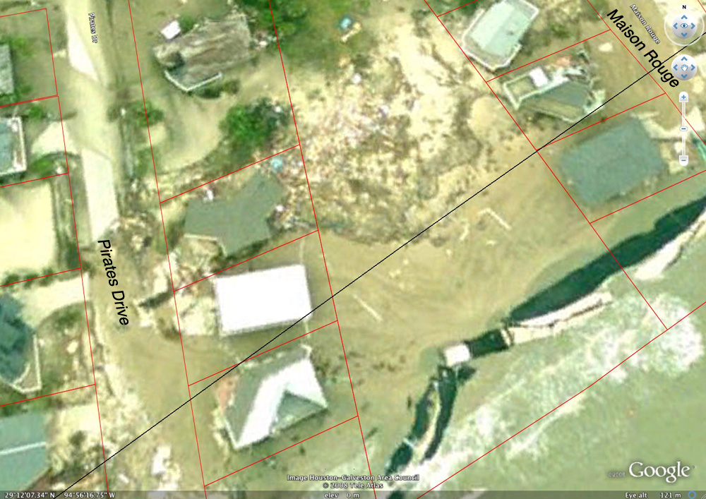
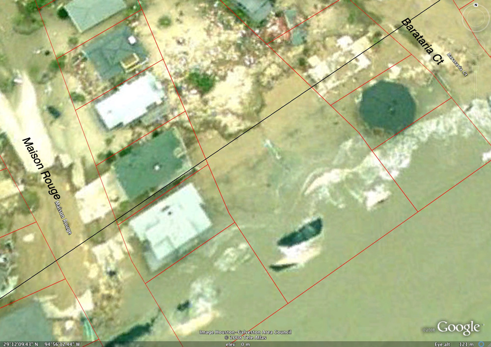
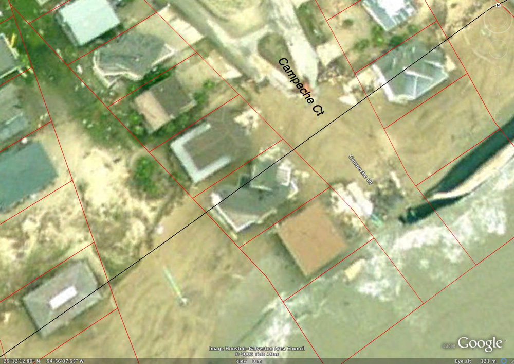
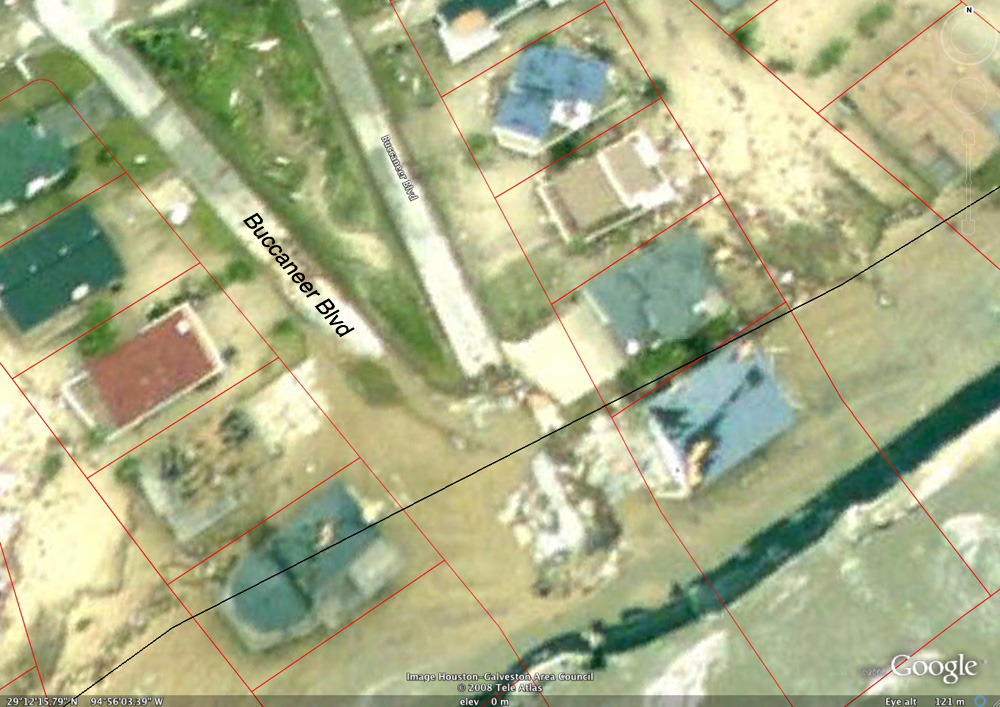
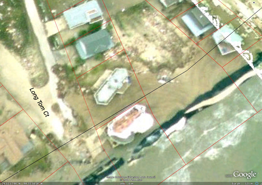
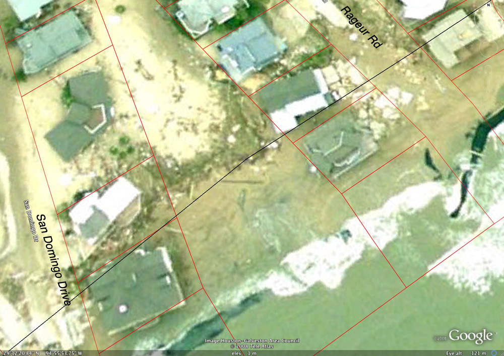
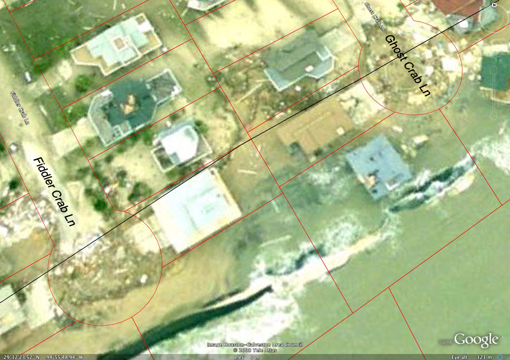
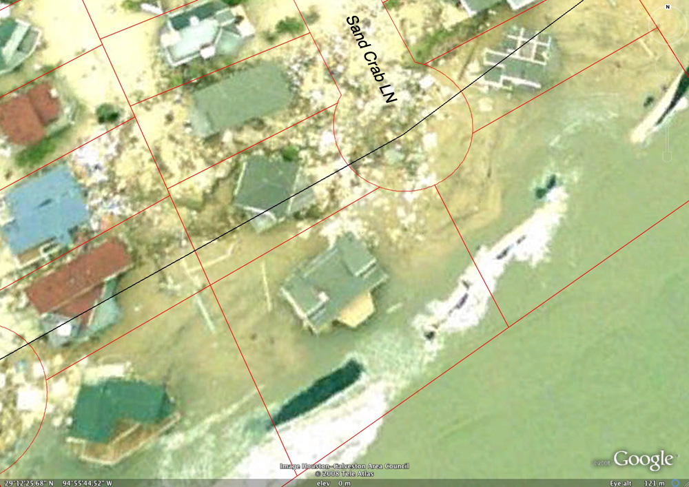
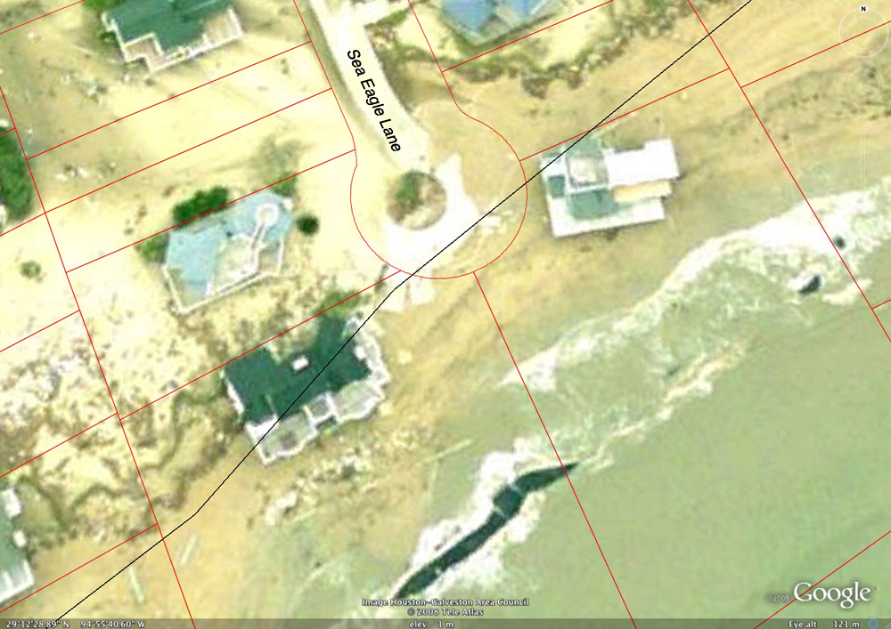
On November 11, 2008, the Texas General Land Office issued a map of Galveston and Bolivar which established an initial post-Hurricane Ike vegetation line. Traditionally, the land office used the vegetation line to mark the public beach boundary, but Ike destroyed so much vegetation that the land office is temporarily using a line 4.5 feet above sea level instead. Where the boundary lies is important because under state law, any property on the Gulf side of the line belongs to the state. No new structures can be built there and houses that end up on the beach must be removed. Texas Land Commissioner Jerry Patterson said those regulations won't be enforced for at least a year. Property owners can get emergency permits to make certain repairs to houses now on the beach, he said. Galveston County Commissioner Patrick Doyle said adopting the 4.5-foot line allows property owners and local officials a starting point to begin rebuilding in the devastated area. The 4.5 foot initial vegetation line is shown as the black line on the following photos of the Pirates Beach beachfront. To download GLO Earth, go to the land office Web site, www.glo.state.tx.us and click on the Hurricane Response Logo. Then, find and click on the Ike Shoreline Assessment link at the bottom of the list in the green box on the right side of the page. After downloading GLO Earth, the Google Earth program will start and zoom into the upper Texas Gulf Coast. Click off any of the features checked on the "Layers" part of the tool bar to the left. Click on only one of the "NOAA post-Ike Aerials" listed under the "Places" portion of the tool bar. Zoom into a particular area to view what it looked like on the day that was clicked above. A sliding bar under the "Places" portion of the tool bar allows the user to change the view from just after the storm to one taken before the storm. A user must first have the Google Earth program, available free at earth.google.com |
| West part of Pirates Beach West |
| East part of Pirates Beach West |
| West edge of Pirates Beach |
| Pirates Beach: Pelican Ln and Spoonbill Ln
|
| Pirates Beach: Pirates Drive to Maison Rouge
|
| Pirates Beach: Mainson Rouge to Barataria Ct
|
| Pirates Beach: Around Campeche Ct
|
| Pirates Beach: Buccaneer Blvd and a block to the East
|
| Pirates Beach: Long Tom Ct and a block to the east
|
| Pirates Beach: San Domingo Drive to Rageur Rd.
|
| Pirates Beach: Fiddler Crab Ln to Ghost Crab Ln
|
| Pirates Beach: Centered on Sand Crab Ln
|
| Pirates Beach: Eastern part, centered on Sea Eagle Lane
|
|